By Mike McGann, Editor, The Times @mikemcgannpa
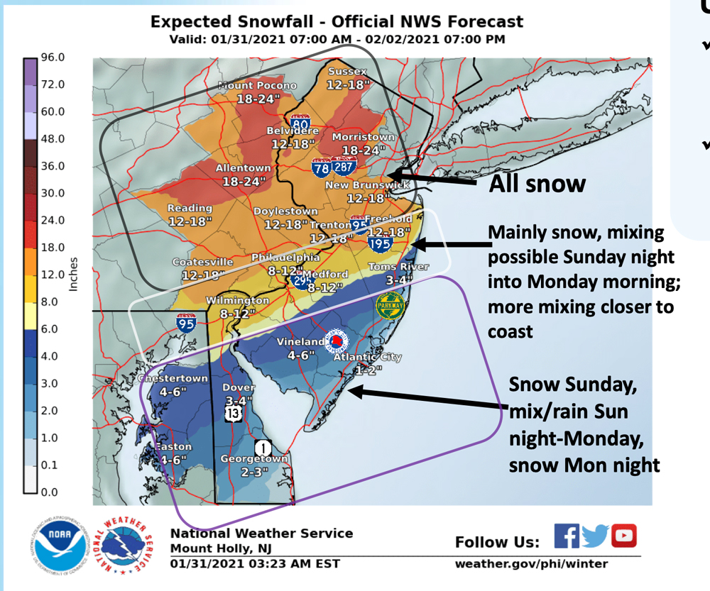 The first major snowstorm in nearly two years is expected to hit Chester County Sunday, bringing 12 to 18 inches of snow, high winds and potentially hazardous traveling conditions on Monday and into Tuesday, according to the National Weather Service (NWS).
A Winter Storm Warning went into effect at 10 a.m. warning of a possible Nor’easter, heavy snow, high winds and dangerous traveling conditions.
The snowfall is expected to start around midday Sunday, starting with the southern and western portions of the county, with 2 to 4 inches of snow expected in much of the county by nightfall. It may switch to rain and ice in the overnight period. The heaviest snowfall is expected to happen on Monday, with the possibility of snow falling at more than one inch per hour at some points during the day. The snow should taper off into the evening, and end sometime Tuesday morning.
There still remains some question as to the track of the storm — which means snowfall amounts could vary greatly, according to the NWS. The highest snowfall is expected in the northern portions of the county, but the current computer model suggests all of the county can expect at least a foot of snow.
Coupled with the snow, high winds, gusting as high as 45 miles an hour are expected, which could lead to blizzard-like conditions, making road travel very hazardous Monday. Additionally, the high winds could lead to scattered power outages around the county.
Chester County’s Department of Emergency Services is advising against travel on Monday, doing so only if necessary, and then only during daylight hours. DES also suggests residents should sign up for ReadyChesco at readychesco.org to get the latest updates and important storm information.